Operation Scarlift Reports
 Operation
Scarlift was a Pennsylvania state program which operated in the 1960's and
1970's whose purpose was to remediate ravages of land and water from historic
mining practices. In addition to addressing problems such as mine fires,
abandoned strip mine areas, open deep mine shafts, burning refuse banks, and
mine drainage, the project produced numerous studies of areas impacted by old
mining practices.
Operation
Scarlift was a Pennsylvania state program which operated in the 1960's and
1970's whose purpose was to remediate ravages of land and water from historic
mining practices. In addition to addressing problems such as mine fires,
abandoned strip mine areas, open deep mine shafts, burning refuse banks, and
mine drainage, the project produced numerous studies of areas impacted by old
mining practices.
While this information is around 30 years old, it still provides much valuable background information for groups assessing their watershed. The original Technical Assistance Grant (TAG) responsible for funding the development of this website has also included 5 selected Operation Scarlift reports on the website. Funding now enables us to digitize the remaining Scarlift Reports. These reports will be processed and placed on this website continuing into 2005.
The paper versions of the Scarlift reports were "digitized" by using a scanner, translating the individual report pages into a format that is deliverable over the internet. These reports are in the widely used "PDF" format, readable using the freely downloadable "Acrobat Reader" software. The following table lists the Scarlift Reports. Those currently available in this project are underlined. Those in progress are in teal-green and forest green.
| SL Number | Title/Description, of Report | County |
| 143-1 | Alder Run | Clearfield |
| 101.6 | Anderson Creek | Clearfield |
| 145-1 | Babb Creek | Tioga |
| 111 | Beech Creek | Centre |
| 195 | Bennett Branch of the Sinnemahoning | Clearfeld-Elk-Cameron |
| 147 | Big Scrubgrass Creek | Venango |
| 182 | Blackleggs Creek | Indiana |
| 185 | Blacklick Creek | Indiana-Cambria |
| 135-11-101.6 | Catawissa Creek | Carbon - Luzerne |
| 140 | Chalfant Run | Allegheny |
| 102 | Chartiers Creek (1968) | Allegheny- Washington |
| 102 | Chartiers Creek (1970) | Allegheny- Washington |
| 101.7 | Clearfield and Moshannon Creek | Clearfield |
| 1001 | Cogley Run | Clarion-Venango |
| 159 | Cowanshannock Creek | Armstrong |
| 107-2 | Crooked Creek - Ernest Mine Complex | Indiana |
| 107-6 | Crooked Creek - Tanoma Complex | Indiana |
| 138 | Cucumber Run | Fayette |
| 193-1 | Deer Creek | Clarion |
| 193 | Deer Creek | Clarion |
| 151 | Dents Run | Elk |
| 108-3-1 | Drill Log Records | McCain |
| 108 | East Branch Clarion River | Elk |
| 160 | English Run | Lycoming |
| 107-4 | Ernest Mine Complex | Indiana |
| 186 | Georges Creek | Fayette |
| 117 | Phillipsburg-Hawk Run AMD Demo Project | Clearfield |
|
117-1 117-2 |
Clearfield |
|
| 110-4-1011 | Highland Fuel Area | Mercer |
| 130-2 | Hillman State Park (Raccoon Creek) | Washington |
| 116 | Horseshoe Curve - Altoona Watershed | Blair |
| 103-5 | Irwin Syncline Basin | Westmoreland |
| 135 | Jeansville Basin | Carbon-Luzerne-Schuylkill |
| 115 | Kettle Creek | Clinton |
| 139 | Lackawanna River | Susquehanna |
| 130 | Langeloth - Francis Mine Complex (Raccoon Creek Watershed) | Washington |
| 194 | Licking Creek | Clarion |
| 164-1 | Little Conemaugh River Basin | Cambria |
| 167 | Little Schuykill River | Schuykill |
| 110-3-1 | Location Map of Drill Holes and Drill Logs - Slippery Rock Creek | Butler-Mercer |
| 110-1C | Location Map of Drill Holes and Drill Logs -Slippery Rock Creek | Butler-Mercer |
| 122 | Loyalhanna Creek | Westmoreland |
| 188 | Loyalsock Creek | Sullivan-Wyoming |
| 173 | Mahoning Creek | Jefferson-Clearfield |
| 197 | Mahanoy Creek | Northumberland |
| 103-9 | Mashudda Strip Mine | Washington |
| 132-6 | Mead Run | Elk |
| 133-5 | Mill Creek | Clarion |
| 181.4 |
Mine Drainage Pollution Abatement Study Mill Creek - Luzerne County |
Luzerne |
| 162 | Moon Run | Allegheny |
| 162-1 | Moon Run | Allegheny |
| 155 | Muddy Run | Clearfield |
| 181.3 | Nanticoke, Warrior, and Solomon Creeks | Luzerne |
| 181.2 | Newport Creek | Luzerne |
| 199 | North Branch Bear Creek | Butler |
| 157 | Piersons Run | Allegheny |
| 192 | Piney Creek | Clarion |
| 135-10 | Quakake Tunnel | Carbon |
| 130-7 | Raccoon Creek | Allegheny- Washington |
| 112 | Rausch Creek | Schuykill |
| 141 | Redstone Creek-Abatement Survey | Fayette |
| 141-2 | Redstone Creek | Fayette |
| 123 | Saw Mill Run | Allegheny |
| 113 | Shamokin Creek Watershed | Columbia-Northumberland |
| 118 | Shaw Mines Complex | Somerset |
| 118-6 | Shaw Mines Complex | Somerset |
| 104 | Slippery Rock Creek Treatment Plant | Butler |
| 110 | Slippery Rock Creek | Butler-Mercer |
| 110-7 | Slippery Rock Hygrogeologic Assessment | Butler-Mercer |
| 110-3 | Slippery Rock Water Samples | Butler-Mercer |
| 103-4 | Southern Latrobe Syncline | Westmoreland |
| 130-1 | State Game Lands Number 117 | Washington |
| 179 | Stony Creek | Somerset |
| 126-1 | Swartara Creek Part I | Schuykill |
| 126-2 | Swartara Creek Part II | Schuykill |
| 126-3 | Swartara Creek Part III | Schuykill |
| 136-1 | Tioga River | Tioga |
| 132 | Toby Creek | Elk |
| 191 | Toby Creek Clarion County | Clarion |
| 114 | Treatment of Brackish Waters | Washington |
| 146 | Turtle Creek | Westmoreland |
| 109 | Two Lick Creek | Indiana |
| 107-6 | Upper Crooked Creek Watershed | Indiana |
| 132-5 | Upper Little Toby Creek | Elk |
| 163-3 | West Branch Susquehanna | Clearfield |
| Wyoming Valley | ||
| 156 | Yellow Creek | Butler |
| 103 | Youghiogheny River Basin | Somerset-Fayette |
Note: These reports have been broken down by section so that download times are manageable. Nevertheless, you may experience significant download times, especially on dial-up connections.
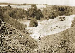
For an historic look, see Operation Scarlift And Mine Reclamation in Pennsylvania..